|
|
|
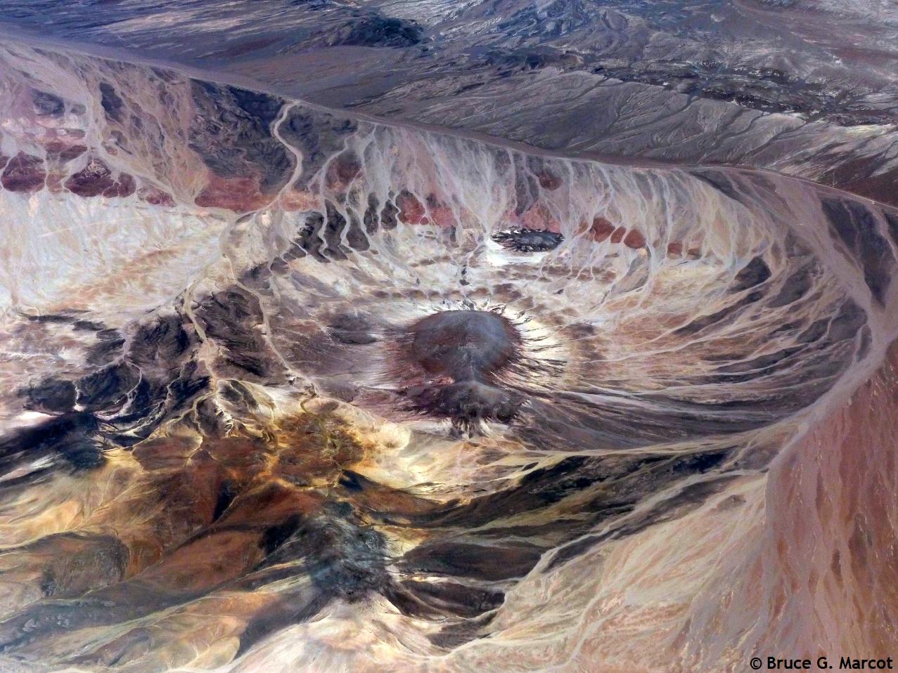
Mystery Crater of the Atacama |
|
|
|
|
|
Mystery Crater of the Atacama |
|
Atacama Desert, Chile |
Credit & Copyright: Dr. Bruce G.
Marcot
|
Explanation: This image is real! I shot this during a flight along the Atacama Desert region of Chile, South America, en route from Santiago north to Calama. What is this crater? We previously viewed an open-pit mine along this same flight route, but that was clearly carved by people, with its many terraced layers. Could this be a meteor impact crater, such as the Monturaqui impact site, which does occur along this flight route in northern Chile? Or could it be the exposed dome from a volcanic eruption? Or could it be a dried playa basin, with the many streamlets feeding into its center? After a few brief tries, I've
been unable to match the image to any shown in Google Earth and other
geography image programs. So for now, I simply view this as the ...
Mystery Crater of the Atacama. |
Next week's picture: To Be Determined
< Previous ... | Archive |
Index |
Location | Search | About EPOW | ... Next >
Google Earth locations
shows all EPOW locations;
must have Google Earth installed
Author & Webmaster: Dr. Bruce G. Marcot
Disclaimers and Legal Statements
Original material on Ecology Picture of the Week © Bruce G. Marcot unless denoted otherwise